
Climate zones and climate diagrams
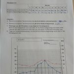
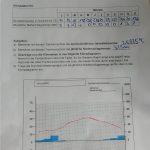
Class 8-10 B has learned about the difference between climate and weather. We can watch the weather in out town for a moment, a day or a month, but climates are what we notice for longer terms. The students learned how to design climate diagrams. They took the values for temperature and rainfall, calculated the average temperature for one year and added the rainfall for one year. After that, they drew climate diagrams with lines and columns to explain the particularities of the place.
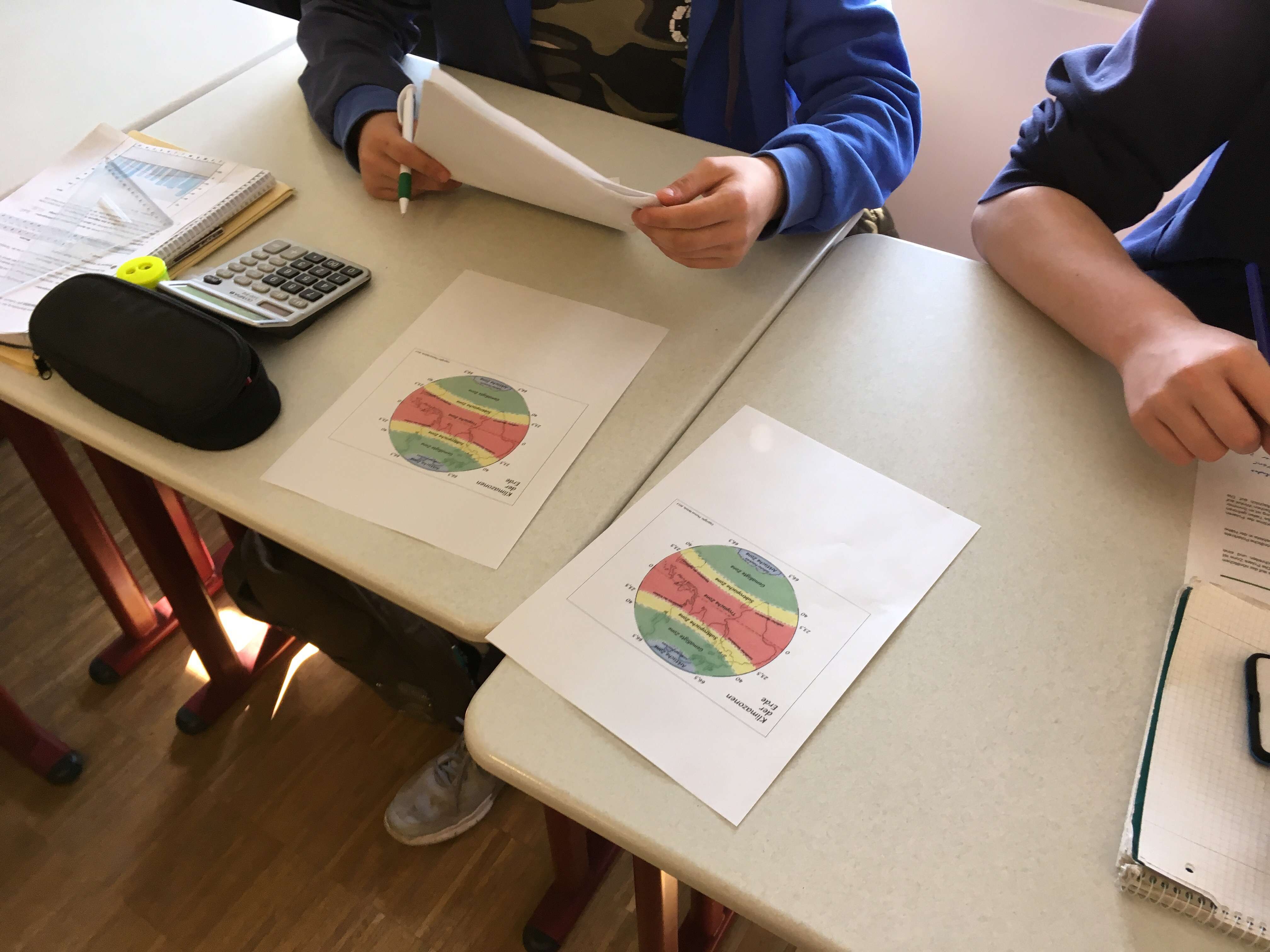
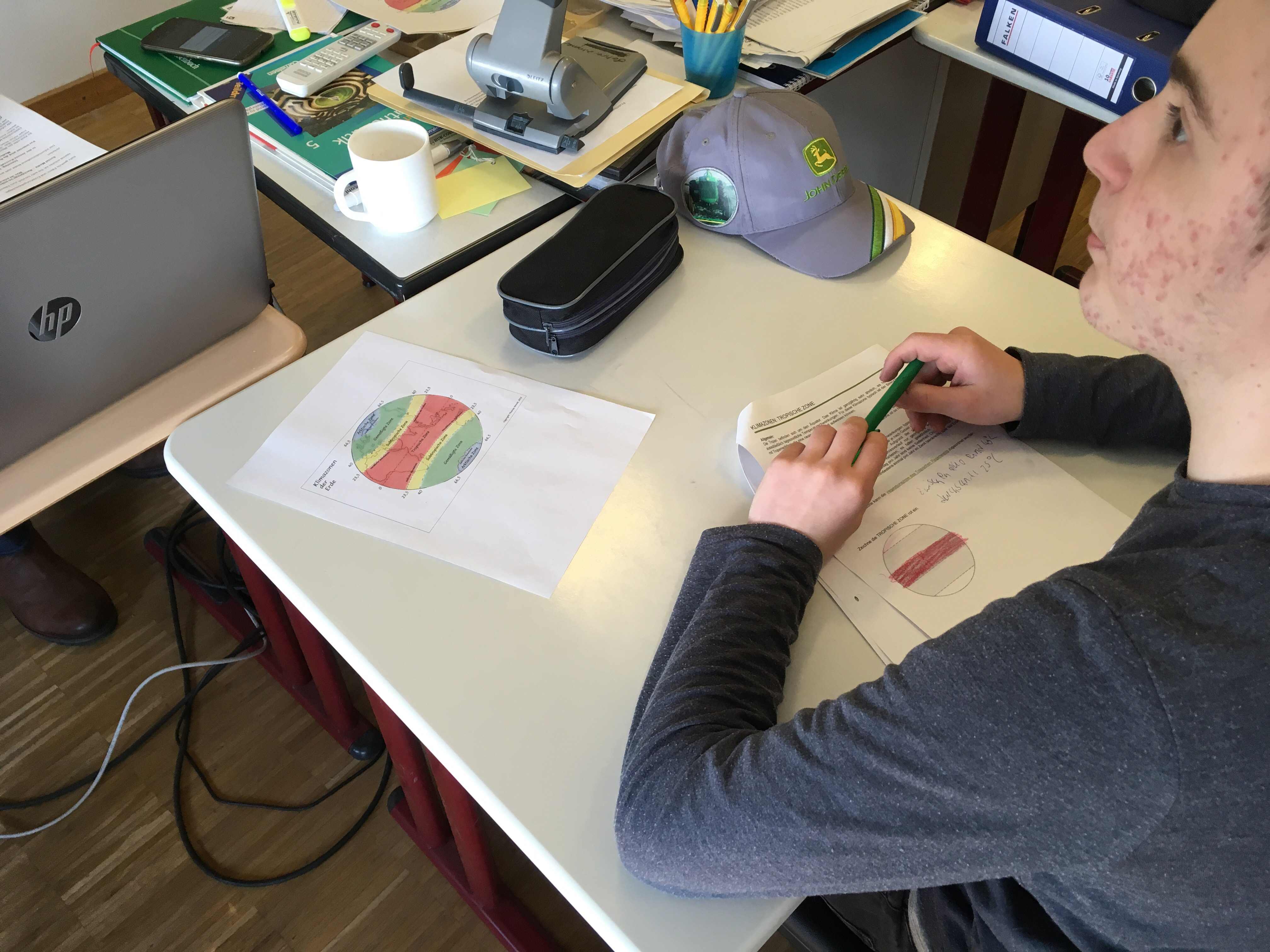
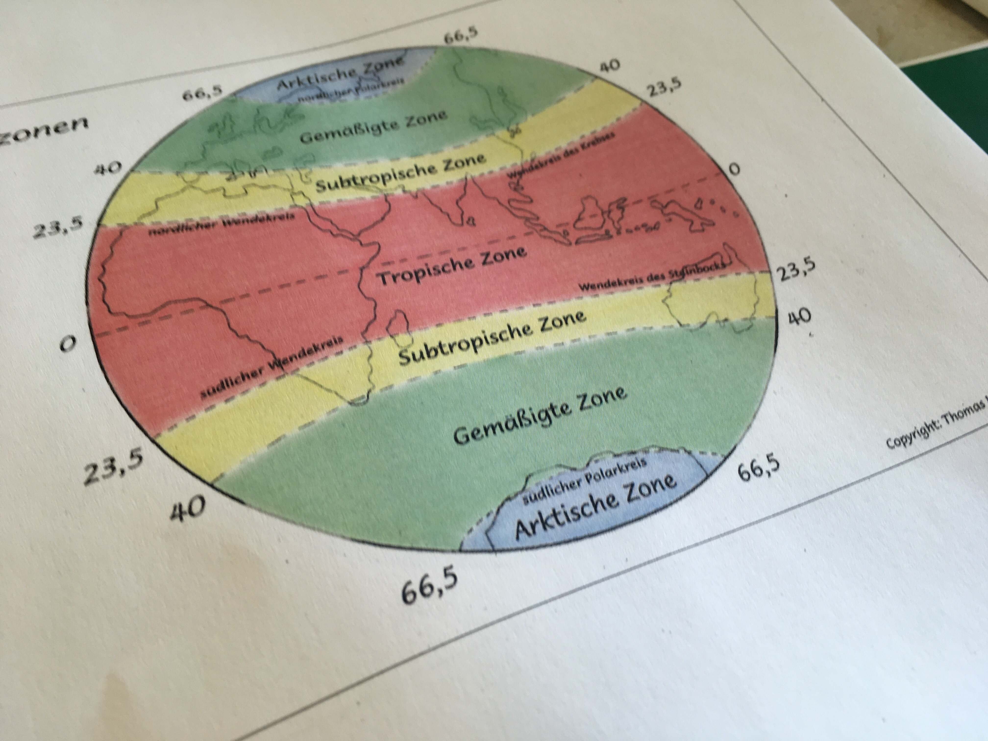
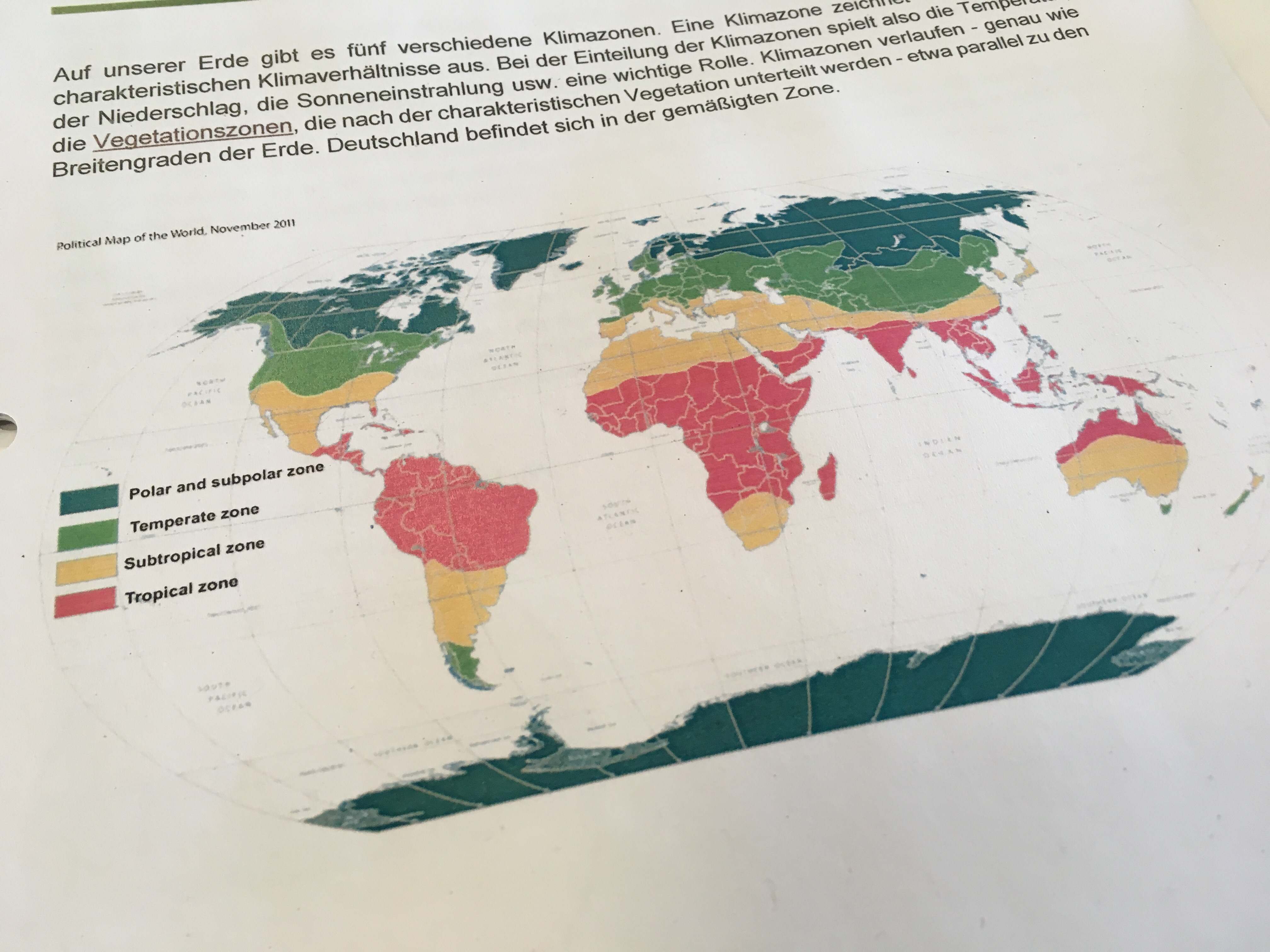
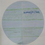
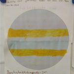
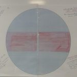
In another lesson, the students examined the four main climate zones of the Earth. They discovered what is typical for the polar zone, the temperate climate, the subtropics and the tropics. They designed drawings of the Earth and assigned the zones to the planet. Finally they created diagrams of typical towns in all climates of the Earth and learned in which zone these places have to be located.
In our weekly youth conference, the students presented their results in front of the other students of secondary school.


The allocation of four places to the climates is here:
-

- polar zone
-
- tempered climate
-
- subtropics
-
- tropics
-
- Whitehorse/Canada
-
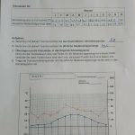
- Berlin/Germany
-
- Cairo/Egypt
-
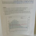
- Fortaleza/Brazil